On this page you will find:
- Geodiversity Overview
- Key Facts and Figures
- Sustaining the Landscape
- Manage Influences and Forces for Change
- Policies and Priorities
Geodiversity Overview
The Isle of Wight AONB has a very diverse geology within a condensed area. The geology of the Isle of Wight AONB is the bedrock upon which all its other special qualities and characteristics are founded. The landform of the AONB is due mainly to the faulting, folding, erosion and ground movement of the underlying geology. The topography of the landscape has influenced where people have decided to settle to access fresh water, take advantage of shelter from prevailing weather and where sites were chosen for ceremonial purposes, such as burial mounds on ridge lines. The geology has provided hard building materials for local vernacular architecture including chalk, limestone and sandstone and the conditions for growing timber and reed/straw materials for thatching. All these contribute to the local distinctiveness and character of traditional buildings.
This geological complexity, in a relatively small area, has created a diverse and varied landscape much of which is important at a local, regional, national, and international scale, evidenced by various designations.
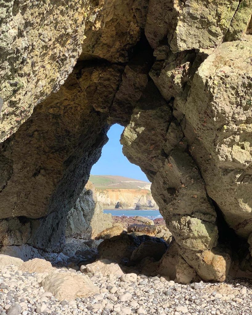
Chalk is arguably the most dominant landform of the Isle of Wight AONB, with the central chalk ridge running from the eastern point at Culver to the western point at The Needles. A second area of chalk downland is in the south above the towns of Shanklin and Ventnor and the villages of Niton, Whitwell and Wroxall. Inland areas of the chalk have an undulating form and often include secluded steep-sided combes contrasting with dramatic white chalk cliffs at the coast. Chalk downland is a key feature in most views in and from the Isle of Wight AONB.
Coastal geology is a major feature of the natural beauty of the Isle of Wight AONB including:
- A nearly complete exposure of the Cretaceous Period (formed between 126 million and 65 million years ago) along the coastline of the Tennyson Heritage Coast.
- The clays, sands and silts of the Palaeocene, Eocene and Oligocene periods (formed between 65 million to 30 million years ago), a feature of the Hamstead Heritage Coast and part of the Tennyson Heritage Coast (Alum Bay to Totland).
- The vertical multi-coloured Bracklesham, and Bournemouth groups clay and sandstone strata at Alum Bay.
- The fossil-rich Wealden Group clays at Brook Bay and Yaverland.
- The impressive ravines or ‘Chines’ formed by streams incising through the rocks to the seashore.
- The dramatic land-slipped Gault and Upper Greensand picturesque landscape of the Undercliff (with its own south facing microclimate, scenic beauty and the accolade of being the most populated rotational landslide complex in north-western Europe).
North of the central chalk ridge the clays, sands and silts create wetter heavier soils and have led to a more pastoral, gently rolling, and wooded landscape in these parts of the Isle of Wight AONB. They are also associated with the low-lying slumped wet cliffs along the Hamstead Heritage Coast and the tidal inlets of the Western Yar, Newtown Creek, Kings Quay, Wootton Creek, and the wetlands inland at Thorness Bay.

The coastal zone of this area is rich in archaeological evidence of human activity close to the former Solent River now submerged under the sea. The rocks are also associated with fossilised remains of mammals, alligators, and turtles. Since the early 19th Century rocks and fossils found in the Isle of Wight AONB have been celebrated and the area continues to attract amateur and professional enthusiasts.
A series of lower sandstone hills lies immediately to the south of the central chalk downs running across the AONB from Compton in the west to Yaverland in the east. These rolling hills are often the location of spring lines which along with the shelter they afford led to the establishment of settlements close by. Sandstone is also the underlying geology of the open, fairly flat plains between Atherfield and Rookley and beyond Arreton to Yaverland. In some parts of this area there are alluvial deposits over the free draining sandstone making them some of the best areas for cultivation. Where the sandstone meets the sea, often tall vertical red cliffs add to the character of the coastline.
Periods of rapid climate change and associated changes to sea levels (including the final inundation of the Solent around 8000 years ago) led to the creation of many of the landform features of the Isle of Wight AONB that we value today.
Key Facts and Figures
The Isle of Wight hosts 40 Sites of Geological Conservation Review, 30 of which are in Isle of Wight AONB.47
There are 4 Site of Special Scientific Interest (SSSI) designated specifically for Geological Interest in Isle of Wight AONB.48 There are 2 Regionally Important Geological / Geomorphological Sites (RIGS).
Sustaining the Landscape
The Isle of Wight geology underpins the Island’s water supply, mineral resources and leads to information about understanding the development of life on Earth. Understanding the geology helps determine settlement placement, and identifying where resources such as gravel, sand or mineral and hydrocarbon (oil, shale gas) deposits could be found on land or immediately offshore. It also highlights landslide areas and areas susceptible to erosion.
Mineral extraction poses a specific threat to certain sites across the Isle of Wight AONB. Good management of these sensitive sites is paramount to ensure any finds which would advance the geological understanding of the Island are not lost (go to page on Minerals).
Although the Isle of Wight AONB is protected from the direct impacts of exploration and extraction of oil and/or shale gas, indirect impacts may have an influence upon the Isle of Wight AONB, and these will need to be fully considered in any development proposals (go to page on Energy).
The Island’s spectacular and varied geology records over 125 million years of changing climate, geography, and animal and plant life (Paleo-environments). The Isle of Wight is recognised as the best site in Europe for dinosaur remains, with fresh exposures revealed in the ever-eroding cliffs. Large numbers of early Cretaceous dinosaurs have been found. These factors lead to an increasing market and potential for geological and paleontological tourism and educational activities.

The greatest threat to sites is from falls and cliffs with collapsing faces. While this is inevitable, it is important to record information as it becomes available to ensure it is not lost. Climate change is expected to exacerbate the rate of site loss of certain sites, most notably along the Tennyson Heritage Coast. It is important to note that interference with natural erosion and sedimentation though coastal management techniques need to undergo the appropriate scrutiny to ensure their impacts do not extend beyond what is unavoidable to fulfil their function.
Management Influences and Forces for Change
Geodiversity Action Plan
The UKGAP49 sets out a framework for geo-diversity action across the UK. It provides a shared context and direction for geo-diversity action through a common aim, themes, objectives, and targets which link national, regional and local activities. The UKGAP is a mechanism for encouraging partnership, influencing decision makers, policy makers and funding bodies, and promoting good practice. It also establishes a shared understanding of what is happening and what needs to happen to promote and conserve geo-diversity, a process for measuring and reporting on progress and, importantly, celebrating success.
Isle of Wight Local Geo-Diversity Action Plan (LGAP)50
The primary function of the Isle of Wight LGAP is to formulate a strategy to promote the Isle of Wight through the conservation and sustainable development of its Earth Heritage.
The Plan sets objectives, targets and determines indicators that will focus resources to conserve and enhance the heritage. The secondary function is to produce for the first time an electronic database audit of the Island’s geo-diversity.
Isle of Wight Shoreline Management Plan (SMP2)39
The Isle of Wight coast will change over the next 100 years due the impacts of marine erosion, ground instability and flooding by the sea. Current levels of risk are likely to increase through greater human activity and development in coastal areas and as a result of the predicted impacts of climate change. Responsibility for management of the Island’s coastal defences against erosion and sea flooding is shared between the Isle of Wight Council, private landowners, and the Environment Agency. The Shoreline Management Plan, published in 2011, was developed as a means by which these organisations could determine, with stakeholders, the best way to look after the coast in a sustainable way for the next 100 years. It was prepared using guidelines set down by DEFRA, the Government Department with responsibility for setting national policy for defence of the coastline.
For the Isle of Wight AONB areas SMP2 strategy has identified various approaches to the appropriate defence of stretches of coastline from some form of protection through to allowing for natural processes to take place. The West Wight Coastal Flood and Erosion Risk Management Strategy26 gives greater detail on these options for the north-west coast of the Island from Freshwater Bay, around the Needles to East Cowes incorporating the estuaries at Yarmouth, Newtown, and the Medina. In the Isle of Wight AONB, investment would be directed to reducing risks in areas around Yarmouth. A coastal study to identify priority schemes for Sandown Bay and Ventnor is currently underway.
Fossil Finds
Many people enjoy searching for fossils, which have been washed out from the cliffs onto the beaches. Not all finds are reported or taken to local experts for identification. This means the important record of what they are and where they have been found is lost.
Inappropriate and un-authorised excavation of cliff faces, or former mineral working sites can be dangerous for those taking part, damaging to the resource and in some cases a criminal offence. Finds from this activity are rarely reported.
Policies for Geology and Geomorphology
These policies should be read in conjunction with the overarching objectives for the Isle of Wight AONB as detailed on the welcome and overview page – Isle of Wight National Landscape: Area of Outstanding Natural Beauty Management Plan 2025-2030 – Isle of Wight National Landscape.
P6 Ensure that AONB objectives are given full regard in the development and review of strategic plans and policies relating to geology and geomorphology.
P7 Support the development of educational activities based on the complex geology of the Isle of Wight AONB, that increases peoples’ knowledge and appropriate enjoyment of the resource.
P8 Promote the importance of recording all paleontological finds and deposits and support initiatives that assist their identification by appropriate organisations.
Priorities for Delivery
- Support the further development of the Local Geo-diversity Action Plan.
- Encourage appropriate promotion of geological and paleontological tourism and educational activities including approaches to encourage appropriate fossil collecting which prevents damage to the resource and provides information on finds and deposits.
- Support continued investigations into international recognition of the quality of the Isle of Wight AONB geology such as UNESCO Geopark status.